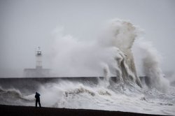
Those dreaming of a white Christmas could be in for a merry surprise, as new weather maps suggest snow may arrive just hours before the festive day. Forecaster WXCharts's latest predictions include a map turning purple over northern Scotland at midnight on Wednesday, December 24, predicting snowfall across the Scottish Highlands and Cairngorms National Park. Another map predicts snow could fall as early as Tuesday, December 23, particularly around 6 pm, affecting areas such as Inverness, Fort William, the Highlands, and the Cairngorms.
According to other forecaster NetWeather, the snow risk could stretch for nearly 400 miles, potentially even reaching Northern England, though northern Scotland remains the primary area of impact. The forecast indicates a 80% probability of snow in locations such as Glasgow, Manchester, and Derby.
The Met Office , however, offers a more cautious view. Its long-range forecast for the period of December 14 to December 23 reads: "A continuation of a similar pattern to that seen through early December is anticipated, especially at first, as frontal systems from the Atlantic spread into and across the UK, interspersed with some temporary drier interludes.
"These will bring spells of rain, which may be heavy at times leading to the risk of some impacts given how wet it has been lately, especially in the west.
"In addition, there is also potential for some periods of strong winds at times too. Whilst it will often be mild, later in the period there may be a slight downward trend in temperature, especially across northern parts of the UK, and the chance of drier spells increases. There may also be a slightly higher chance of some wintry hazards at times in the north."
The Met Office's long-range forecast for the period of December 24 to January 7 also reads: "Changeable conditions are likely to give way to slower moving weather patterns through this period, however the detail remains highly elusive.
"This means that whilst outbreaks of rain and showers remains probable at times there will also be drier interludes, which may be more prolonged than of late.
"Some spells of strong winds are possible but in the drier periods frost and fog becomes likely. On balance temperatures will likely be near normal with any snowfall most likely in the north over higher ground."
The Met Office has previously explained the difficulty of forecasting snow in the UK, particularly more than a few hours in advance.
Small changes in temperature, wind direction, or precipitation intensity can determine whether an area sees rain, sleet, or snow.
Heavy bursts of precipitation can cool the air enough to produce snow, while lighter showers can often also melt before reaching the ground.